
An Interview with the Creators of Landmapper
Our partners over at Ecotrust are releasing a new tool that makes forest maps accessible in a matter of minutes, with no specialty knowledge needed. The maps are available for most properties in Oregon and Washington, with more updates coming over the next few months. We chatted with two of the program’s creators, Director of Forestry Technology David Diaz and Senior Data Scientist Sara Loreno, about the launch of the new tool.
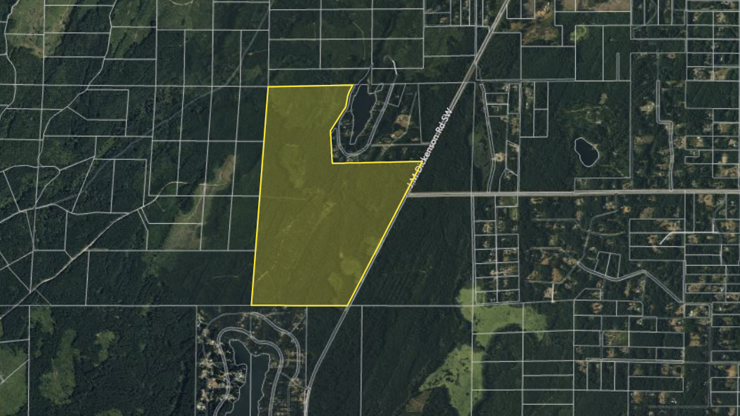
NNRG: So Ecotrust and its partners are in the process of launching Landmapper, which is a website that provides downloadable maps for forest landowners in OR and WA. Could you tell us a bit about what motivated you to create this tool?
David Diaz: As we were doing workshops around Oregon and Washington for our Forest Planner web app, we kept encountering small forest owners who were trying to complete Forest Management Plans but were finding it challenging to map out and identify the current forest conditions on their property. We realized we could auto-populate most of the maps that go into these plans using publicly available data, and have focused that new functionality into Landmapper.
Sara Loreno: Yes, we found that both small woodland owners and professional foresters were spending quite a bit of time pulling together all the various data and imagery that is needed when preparing a management plan. We simplified that process by compiling the various data sources into a series of maps and attribute tables that can be downloaded by simply clicking on a tax lot.
NNRG: How does this tool differ from other approaches to mapping forests? Is it related to the Forest Planner tool?
SL: The inspiration for Landmapper came from our Forest Planner workshops, but the two tools are independent from each other. Landmapper is more focused on making maps that go into Forest Management Plans, while Forest Planner is meant for comparing how different management scenarios might play out on your land over time.
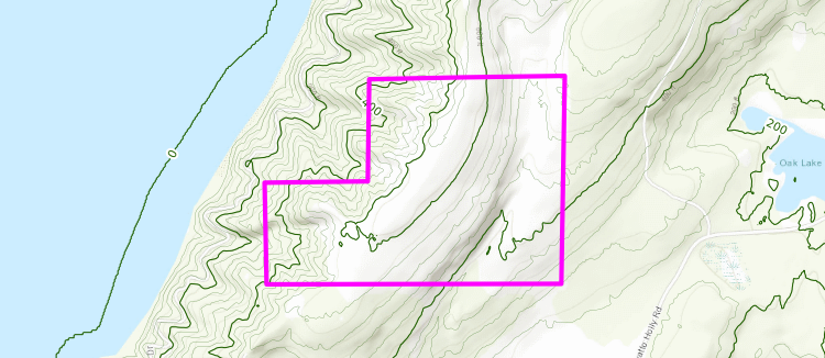
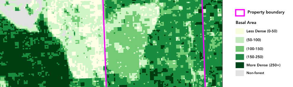
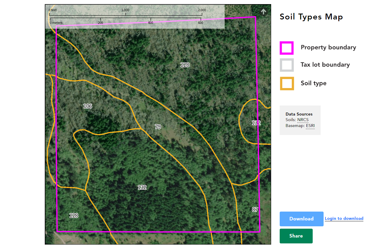
DD: As we were creating Landmapper, we gathered publicly-available data to generate maps of soil types, topography, and streams on a property. But we also had to develop a system to predict forest conditions on the ground (such as forest type, diameter class, canopy cover, etc.) from recent satellite imagery. Maps and tables describing these forest conditions are critical ingredients in any Forest Management Plans, but there were no publicly available datasets that were updated on a regular basis to draw from.
NNRG: Who are you hoping uses and benefits from the site?
DD: We designed Landmapper to make the work of preparing management plans easier for small forest owners and the professional foresters that work with them. We did engage with a broader group of advisors that included people from land trusts, tribes, and state and federal forestry agencies, to make sure the underlying maps and tables we produced would be useful in other contexts. But we wanted to stay focused on making sure Landmapper would directly address the needs we heard coming from small landowners and their foresters.
NNRG: Did you encounter any challenges in making these maps more accessible? Were there any things that surprised you?
SL: We did want to make sure we weren’t duplicating information that was already available through other resources. It has been tempting to add resource information about things like forest management practices, stream type regulations, soil science, professional forester contact information, etc. But taking a step back, we realized there are already resources that do a stellar job of educating landowners (for example, knowyourforest.org), so we made sure to focus on a product that complemented these efforts, and didn’t duplicate them.
DD: The sheer diversity of small forest properties across Oregon and Washington does make it pretty challenging to find the “goldilocks” combination of map styling and data that work for almost everyone without creating a technical interface for users to customize their maps. We aspired to keep Landmapper as simple as possible.
In terms of surprises, we had initially planned to have Landmapper draw forest stand boundaries for each property. Not only did this turn out to be a very difficult process to automate, but we also learned that the division of each unique property into one or more management units was as much about the personal context and interests of a landowner as it was about forest structure and composition. With sage advice from our advisory team, we decided stand delineation was a task best left to landowners and foresters working with them.
NNRG: If folks want to use the website, are there any tips or tricks you’d like to share?
DD: We’re currently working to refresh the data behind the maps in Landmapper on an annual basis, using publicly-available sources. Although the forest type maps we now produce in Washington (and which will be rolling out in Oregon later this year) use satellite imagery from the most recent complete calendar year, the higher resolution aerial imagery we can provide for free and the parcel data we collect from Oregon and Washington agencies are commonly more than a year old. So if the recent subdivision of your tax lot isn’t represented or a recent harvest on your or a neighbor’s property isn’t showing up in the imagery, you’re not going crazy, it might just be that these changes may not appear in Landmapper until the public services we collect these data from are updated again.
NNRG: What’s next for Landmapper?
SL: In addition to providing the annual updates to the maps and tables in Landmapper, we’re working to incorporate georeferencing into the PDF maps we generate. That way people can take these maps out and use them in the woods using mobile apps like Avenza.
NNRG: Anything else you’d like to share?
DD: We worked with a great network of partners and supporters to develop Landmapper over the course of more than six years, and I want to share the credit. This work would not have been possible without the support and input of partner organizations, including NNRG, Wallowa Resources, the University of Washington, and the Oregon Tree Farm System, as well as an Advisory Team including representatives from Columbia Land Trust, the Confederated Tribes of Coos, Lower Umpqua, and Siuslaw Indians, Oregon NRCS, OSU Extension, Oregon Small Woodlands Association, Oregon Department of Forestry, and several small forest owners. And our ability to offer Landmapper for free is due to the generous financial support of Oregon NRCS, the USDA Western SARE program, Oregon Department of Forestry, and the Oregon Tree Farm System.
Check out Landmapper for yourself!
Leave a Reply